

I was probably off in college when my Dad saw an advertisement, probably in the Chicago Tribune, for land in Colorado. Some friends of my parents had moved to Colorado, my parents visited them, and for whatever reason my Dad purchased two 5-acre lots of ranch land 60 miles due west of Pikes Peak.
Years later, when Dad died, my Mom gave one plot to my brother and the other one to me. The taxes are around $140 a year and it’s not only fun to be able to say I have land in Colorado, but it’s given me a place to stop and to walk around a little on my annual trips from the desert Southwest back to Michigan.
Besides, the drive west from Colorado Springs on U.S. 24 is spectacular as it winds through the mountains, past Pikes Peak, and enters a vast valley framed by the 14,000-foot peaks of the University Mountains.
The “ranch” is located near Hartsel, Colorado, and I’ve done a variety of routes from there back to Arizona, where I used to live, or to Nevada, my current residence.
There’s Colorado 9 south to U.S. 50 for a wonderful drive west with the Arkansas River churning to your right. Keep going west and you climb over Monarch Pass. There’s also U.S. 285 south and then U.S. 160 up and over Wolf Creek Pass and down into Pagosa Springs.

On my most recent visit, I tried something different. For the first time, I turned right at the T-bone intersection in Buena Vista instead of left and stayed on U.S. 24.
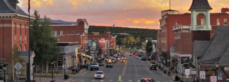
My dog-eared 2006-edition Rand McNally road atlas places dots along 24 all the way from Buena Vista to the I-70. The book’s Legend says those dots indicate a “scenic route.” Wow, were the cartographers correct! The scenery was spectacular and I’m still wondering how the old mining town of Leadville stays attached to the steep face of the mountain on which it was built.
It was only after I got home and was getting ready to write this story several months later that I found my copy of Motorcycle Journeys Through the Southwest and discovered that the road I’d driven was part of what bikers known as the “Peeling the Banana Loop.”
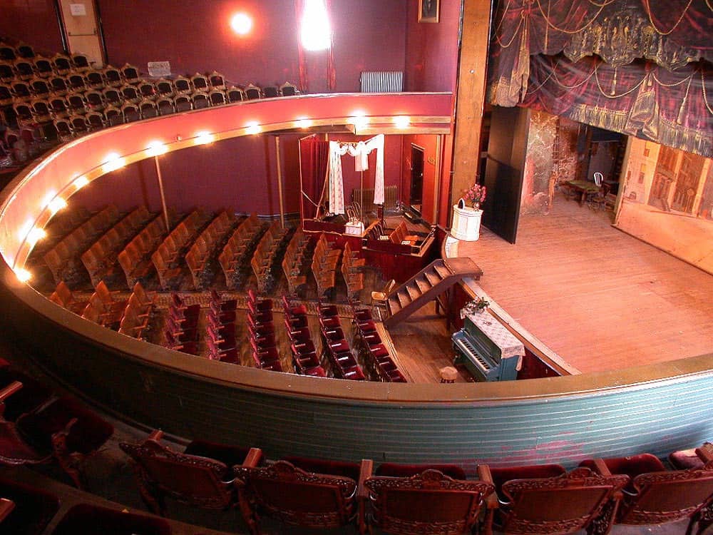
Tabor Opera House 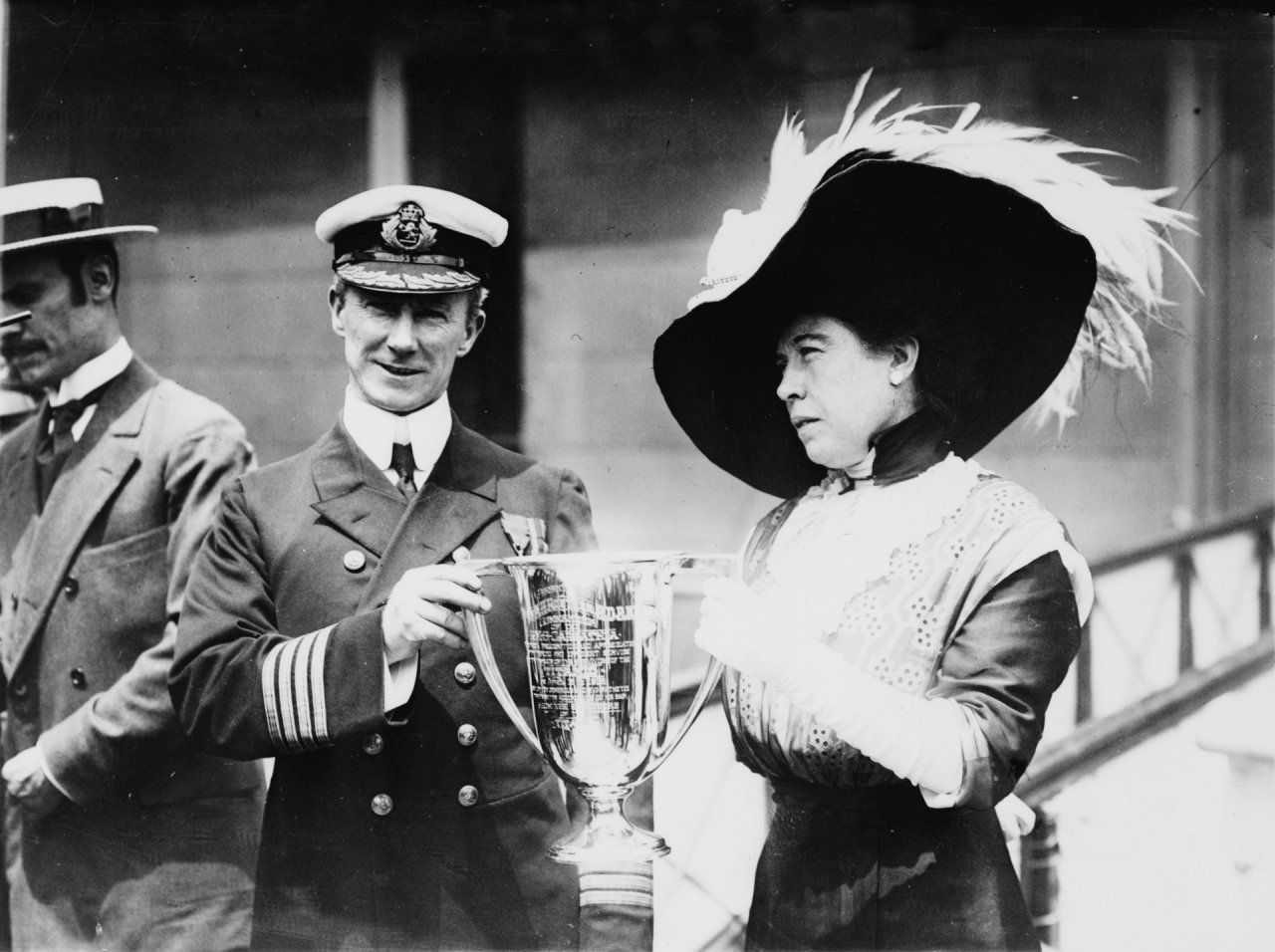
‘Unsinkable’ Molly Brown
Quick note: If you’re looking for guidebooks to great driving roads, check those written for motorcyclists.
Motorcycle Journeys notes that U.S. 24 is the “Highway of the Fourteeners,” because it passes 10 mountains that reach at least 14,000 feet in elevation. It also notes that as you approach Leadville, you pass Mount Elbert, at 14,433 feet the highest of the Rocky Mountains and second-highest in the 48 contiguous states.
It also points out that Leadville, itself perched at 10,152 feet, is known as “Cloud City” and has a rich history, both in terms of mining and stories of romance. Remember the story of the unsinkable Molly Brown, a Titanic survivor? She lived in Leadville.
The area also was the base for the famed 10th Mountain Division, the so-called Invisible Men who, dressed in white like the snow, fought in the Italian Alps during World War II.
I was on a schedule to get home and didn’t linger, but I can assure you that once I feel safe to travel again, and hopefully without the need to be a masked man, I’ll be heading back to the ranch, and definitely will be lingering in Leadville.

Have made that trip from My folks home in Wetmore near Canyon City to Hartsel then back to the springs via 24. Fantastic esp above the river! But the most memorable and my favorite was from canyon city to Cripple Creek via the ledge road.
That ledge road sounds great. I’ll keep that in mind on my next visit to Hartsel. Thought I’d be there in mid-September, but with virus and all, it might be sometime next spring.
Thank-you, Sir for the excellent article. On my last trip out West from FL. I saw Leadville on the map & was quite tempted. I never knew about the “ledge road”, only now because of you I know. As soon as possible, most likely next spring, I will go there & do-it. Imagine living @ 10K elevation??? My suggestion to All is to do the ” Circle in the Sky ” starting @ Durango, CO. going up to Silverton,on the golden highway to Montrose, Then head south to Telluride & finally completing the circle @ Dolores & Mesa Nat’l Park. It is a great 240 mile trip, with plenty of Great RoadHouses. It took me a week, only I hit all of the National Parks along the way. WOW !!! WCCJR.
Reading this “Rocky Mountain High” article from New Zealand makes me oh so keen for our lives to get back to normal and, along with my Brother, we can buy one those great American 60’s / 70’s cars and set off on the road following your designated routes. The areas described sound marvelous, the small towns intriguing, and the sights wonderful. I’ve enjoyed the ride already but looking forward to the real thing.
Thanks so much for the article.
Hi Larry,
What a great story! I’m happy to hear you that you had such a good road trip through Leadville and that next time you will linger longer! I work closely with the Lake County Tourism Panel, which oversees Marketing and PR for Leadville and Twin Lakes. If you’d like any information for a future visit or story, please don’t hesitate to reach out. Also, here’s a link to our website, so you don’t miss anything next time you’re in town! https://www.leadvilletwinlakes.com/
Take care,
Mary Howard
Hi Larry,
Leadville has another “claim to fame” that should be mentioned somewhere:
At 9,934 feet msl, Lake County Airport (LXV), often called Leadville Airport, is North America’s highest elevation airport.
Thanks for the article.
Doug Cross
Hi. I enjoyed your article. I live just East of Hartsel in Divide. The “University Mountains” are actually called the Collegiate Peaks, and the “ledge” road is actually Shelf road. Might make it easier for people to find. Regards.
Suzanne: Thanks for the update. I should have remember Collegiate, not University, and also my bad on ledge instead of shelf. Been too long since I’ve been back. — Larry